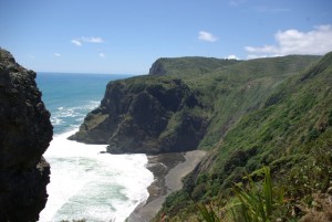
As part of the Te Kawerau a Maki Claims Settlement Act 2015, the New Zealand Geographic Board has restored the traditional names to parts of the West Coast and wider Waitakere.
Three new names have been given and 14 geographic names have been altered, usually by adding the Maori name to existing English names. Most are listed below.
New names
Karangahape Peninsula – a peninsula in the Manukau Harbour that extends from Kakamatua inlet north-east to Mill Bay. The peninsula had no formal name but was locally known as Cornwallis peninsula.
Te-Ihu-a-Mataoho Beach – a beach within Manukau Harbour extending south-east from Renton Road for approx. 1.2 km
Added and corrected names
Manutewhau Creek – a stream flowing east for approx. 3 km to its confluence with Te Wai o Pareira/Henderson Creek
Motumanawa/Pollen Island – narrow island 1.5 km long in Waitemata Harbour – North west motorway runs along its boundary
Paratahi Island – corrected from Panatahi island, Karekare
Tahoro/Union Bay – Karekare
Te Ka-a-Maki/Jackie Hill – a hill at 148m located on the north side of the Manukau Harbour entrance – Jackie was Jackie Marama
Te Rau-o-te-Huia/Mount Donald McLean – a hill at 389m on the north side of the Manukau Harbour entrance, Donald McLean was an early surveyor
Te Toka-Tapu-a-Kupe/ Ninepin Rock – Whatipu
Te Unuhanga-a-Rangitoto/Mercer Bay – between Piha and Karekare. Andrew Mercer obtained the bay as a Crown Grant. The Maori name denotes Tiriwa’s feat in pulling up a mountain – Rangitoto – because it was blocking his view of the entrance of the Manukau – he then strode across to the Waitemata and on entering the cold water of the harbour, dropped it, forming Rangitoto
Te Wai-o-Pareira/Henderson Creek
Wai-o-Parekura Stream, was Te Aute Stream.
Watchman Island/Te Kahawhakaara – small island in the Waitemata Harbour, off Herne Bay


